Skip to content
All cities

Ravni. Things to do, map and hidden gems

12 curated places· 4 hidden gems
Ravni
Photo: Vid Pogačnik / CC BY-SA 4.0

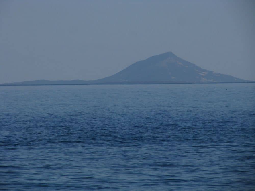
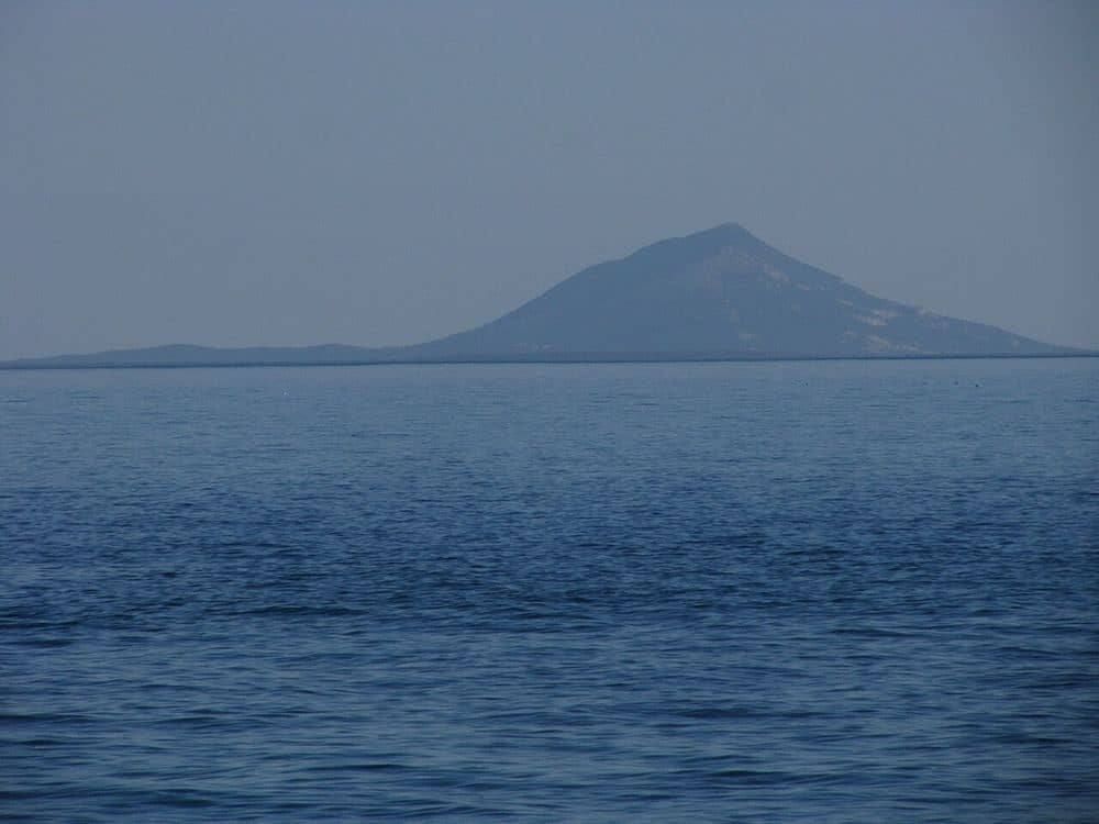
Ravni is one of the smallest places on the Croatian coast with its own page in this atlas: 64 residents, one road, one shop and four hundred metres of beach on Istria's east coast, looking across the Kvarner to Cres. Families from Labin once kept fishing huts here; today they are apartments on terraces above the sea, and in summer the population multiplies by ten and stays quiet all the same.

People choose Ravni for what it lacks: no hotel, no promenade, no nightlife. What it has is clear water with no river to cloud it, a coastal path with coves all the way to Sveta Marina, the Orlić hill with a view over the whole bay, and Skitača, a half-abandoned village at 425 metres with a church from 1616. Labin with its pharmacy and evening life is a quarter of an hour by car, Rabac with its hotels twenty minutes, Pula airport fifty kilometres.

Ravni, Istria: the beach, the coast path, Skitača and what else to see

The next 7 days

Weather data by Open-Meteo.com

Climate month by month

Ten-year averages for Ravni, so you can see what a month usually looks like rather than what this week happens to do.

MonthDay °CNight °CRain daysSea °C
January941013
February1151012
March1371013
April16101014
May20141218
June2619822
July2922726
August2922626
September23181023
October19131120
November1491218
December1161015

Air 2015 to 2024, sea 2022 to 2024. A rain day is 1 mm or more. Data by Open-Meteo.com

Our tips

What we would do around Ravni

Day trips within reach of Ravni, plus the routes and quiet corners our editors keep coming back to.

Hidden gems in Ravni

Orlić viewpoint
Legendary
Activity

Orlić viewpoint

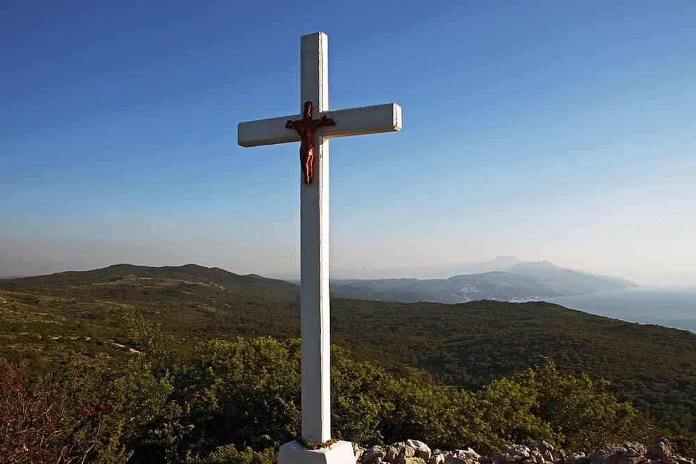
A 470-metre summit above Skitača with a view over the whole Kvarner, from Učka to Cres and Lošinj.

Photo: Vid Pogačnik / CC BY-SA 4.0
Orlić viewpoint
Activity Legendary

Orlić viewpoint

Orlić is the highest of the four hills around Skitača and the easiest to reach: a marked path leads from the church of St Lucy to the top, about twenty minutes up over rocky ground and through low woodland. At the summit there is a stone cairn, a wooden cross and the view that explains why people come. To the north rises Učka with the tower on Vojak, below it Opatija and Rijeka; to the east the whole of Cres with the Osorščica ridge, Krk behind; to the south Lošinj and, on clear days, Unije and Susak. Ravni and Sveta Marina lie below like a model. The best light is late afternoon, when the sun comes from the west behind you and lights the islands; the sunset itself is hidden by Brdo. In winter, after the bura, visibility is greatest. There is no shade and no water, bring both.

Photo: Vid Pogačnik / CC BY-SA 4.0

Ravni Beach
Legendary
Activity

Ravni Beach

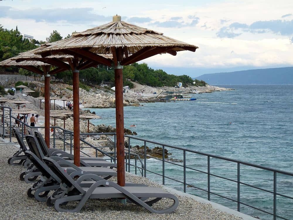
Four hundred metres of pebble and concrete terraces below the village, looking across the Kvarner to Cres.

Photo: Kuhni74 / CC BY-SA 4.0

Ravni Beach
Activity Legendary

Ravni Beach

Ravni beach is the reason a village of some sixty residents has ten times as many people in summer. The shore drops in a long, gentle arc below the houses: fine pebbles in the middle, concrete terraces with ladders at either end, pines behind and a handful of konobas open from May to October. The entry is gradual, which makes it good for children, and the water is as clear as everywhere on Istria's east coast, where no rivers cloud it. The view runs straight across the Kvarner: Cres with the Osorščica ridge lies opposite, and on clear days Lošinj shows to the left. The southern stretch is set aside for dogs, a rarity on this coast. Morning is the best time, as the sun comes off the sea and the beach is warm by noon; in the afternoon the rocks above the village shade the northern end. Parking is by the road above; steps take you down to the water in three minutes.

Insider tip

Come before ten: the car park above the beach has about thirty spaces and is full by noon.

Photo: Kuhni74 / CC BY-SA 4.0

Explore Ravni by category

Sights

4
Ravni village
Sight

Ravni village

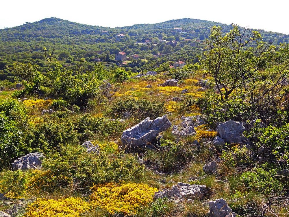
A settlement of 64 residents on a terrace above the sea, once a fishing and farming hamlet of Labin families.

Photo: Kuhni74 / CC BY-SA 4.0
Ravni village
Sight

Ravni village

Ravni belongs to the municipality of Raša and counted 64 residents in the 2021 census, one of the smallest places on this site. It began as a summer hamlet: families from Labin and Raša kept fishing huts and gardens here, and the permanent settlement only grew with tourism from the 1970s. Today it is houses with apartments on two or three terraces above the beach, one grocery, a few konobas and a road that ends at the car park. There is no centre in the usual sense, no church, no square; the place is the shore and the view. Anyone after evening life drives to Rabac or Labin; anyone after quiet is in the right spot. Pharmacy, doctor and post office are in Labin, fourteen kilometres by road, the cash machine in neighbouring Sveta Marina.

Photo: Kuhni74 / CC BY-SA 4.0

Skitača
Sight

Skitača

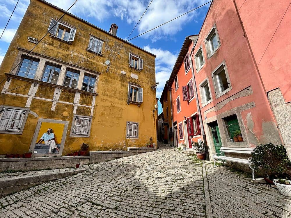
A half-abandoned village on a 425-metre plateau, with the church of St Lucy from 1616 and an educational trail.

Photo: Vid Pogačnik / CC BY-SA 4.0
Skitača
Sight

Skitača

Skitača sits four kilometres south-west of Ravni on a 425-metre plateau ringed by four hills: Goli, Oštri, Brdo and Orlić. The village was founded in the fifteenth century by refugees from the Turks, and its name, probably of Vlach origin, means people who move, wanderers. Only a few families live there now, the stone houses stand scattered across the plateau, and in the middle is the church of St Lucy, built in 1616, with a plain front and a bell gable. Around the church runs the St Lucy trail, a three-kilometre educational path with boards on the karst, the plants and the legend of the saint who wept here until the villagers built her a church. On her feast day, 13 December, people from the whole Labin area come for mass and the blessing of the water. In summer Skitača is the coolest place around: two hundred metres above the coast, always with a breeze, with the Kvarner showing between the hills. The road from Ravni is narrow and paved, ten minutes' drive.

Photo: Vid Pogačnik / CC BY-SA 4.0

Labin old town
Sight

Labin old town

The mining town on the hill, twelve kilometres from Ravni, with baroque palaces, galleries and a view over the Kvarner.

Photo: Olgierd Rudak / CC BY-SA 4.0

Labin old town
Sight

Labin old town

Labin is the town Ravni relies on: the seat of the neighbouring municipality, the pharmacy, the doctor, the market and the nearest place with real evening life. The old town on its 320-metre hill keeps its Venetian walls, a town gate with the lion, the baroque palaces Battiala-Lazzarini and Franković and a narrow main square with a sixteenth-century loggia. Coal was mined under the town for centuries; the National Museum in the Battiala-Lazzarini palace has a replica mine gallery you walk through. Today Labin is a town of artists, with studios and galleries in the old houses, and in summer the square hosts Labin Art Republika with concerts and open studios. The drive from Ravni takes fifteen minutes, the car park is below the old town, from there it is uphill on foot. The Fortica viewpoint at the top looks over Rabac, Cres and Učka.

Photo: Olgierd Rudak / CC BY-SA 4.0

1 more places
  • St Lucy's spring

Activities

8
Orlić viewpoint
Legendary
Activity

Orlić viewpoint

A 470-metre summit above Skitača with a view over the whole Kvarner, from Učka to Cres and Lošinj.

Photo: Vid Pogačnik / CC BY-SA 4.0

Orlić viewpoint
Activity Legendary

Orlić viewpoint

Orlić is the highest of the four hills around Skitača and the easiest to reach: a marked path leads from the church of St Lucy to the top, about twenty minutes up over rocky ground and through low woodland. At the summit there is a stone cairn, a wooden cross and the view that explains why people come. To the north rises Učka with the tower on Vojak, below it Opatija and Rijeka; to the east the whole of Cres with the Osorščica ridge, Krk behind; to the south Lošinj and, on clear days, Unije and Susak. Ravni and Sveta Marina lie below like a model. The best light is late afternoon, when the sun comes from the west behind you and lights the islands; the sunset itself is hidden by Brdo. In winter, after the bura, visibility is greatest. There is no shade and no water, bring both.

Photo: Vid Pogačnik / CC BY-SA 4.0

Ravni Beach
Legendary
Activity

Ravni Beach

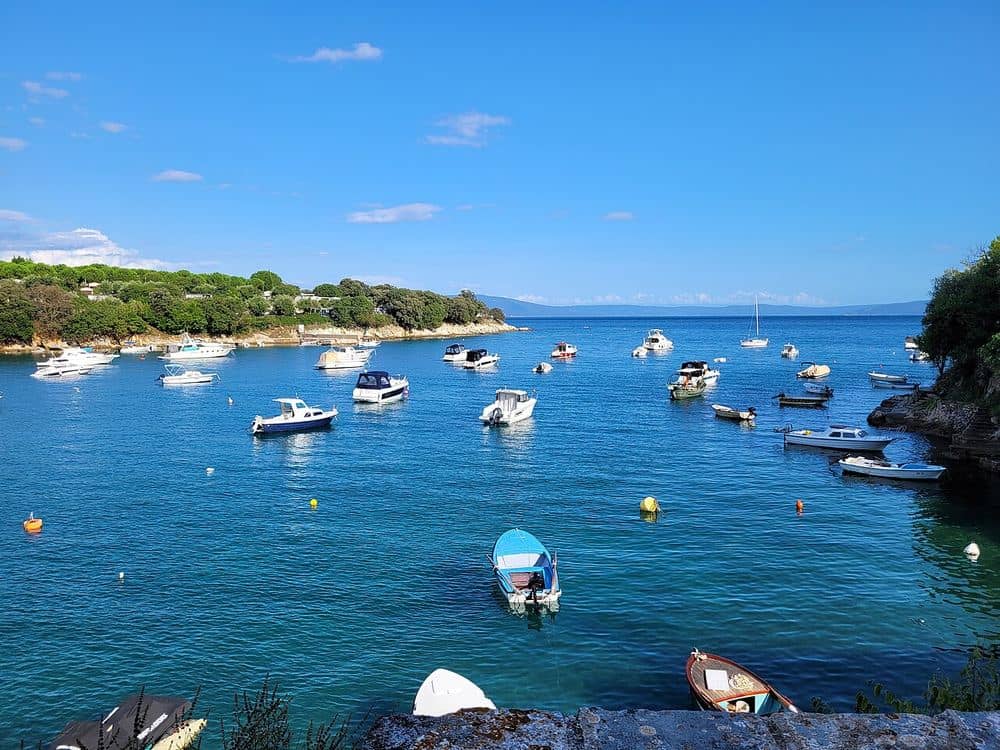
Four hundred metres of pebble and concrete terraces below the village, looking across the Kvarner to Cres.

Photo: Kuhni74 / CC BY-SA 4.0
Ravni Beach
Activity Legendary

Ravni Beach

Ravni beach is the reason a village of some sixty residents has ten times as many people in summer. The shore drops in a long, gentle arc below the houses: fine pebbles in the middle, concrete terraces with ladders at either end, pines behind and a handful of konobas open from May to October. The entry is gradual, which makes it good for children, and the water is as clear as everywhere on Istria's east coast, where no rivers cloud it. The view runs straight across the Kvarner: Cres with the Osorščica ridge lies opposite, and on clear days Lošinj shows to the left. The southern stretch is set aside for dogs, a rarity on this coast. Morning is the best time, as the sun comes off the sea and the beach is warm by noon; in the afternoon the rocks above the village shade the northern end. Parking is by the road above; steps take you down to the water in three minutes.

Insider tip

Come before ten: the car park above the beach has about thirty spaces and is full by noon.

Photo: Kuhni74 / CC BY-SA 4.0

Sveta Marina
Activity

Sveta Marina

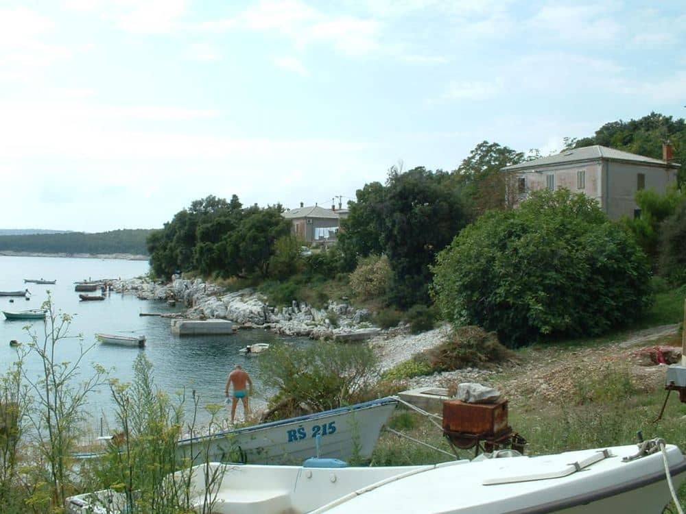
The neighbouring cove with a small harbour, a campsite and the only cash machine around, four kilometres north.

Photo: Mike aus dem Bayerwald / CC BY-SA 4.0
Sveta Marina
Activity

Sveta Marina

Sveta Marina is the first larger place north of Ravni: a deep cove with a breakwater, some thirty berths for small boats, a campsite on the pine slope and a pebble-and-rock beach that runs out to the point. It takes its name from the chapel of St Marina above the harbour. For Ravni it is the service village: the cash machine, a diving centre, kayak and paddleboard hire and the only fuel station for boats on this stretch of coast are here. The drive from Ravni takes five minutes, and the coastal path gets you there on foot in about forty, past several small coves you can climb down to. The restaurant in the harbour runs all season and is one of the few around with fish from its own nets.

Photo: Mike aus dem Bayerwald / CC BY-SA 4.0

Koromačno
Activity

Koromačno

A workers' settlement by the cement plant at the far south of this coast, with an unexpectedly good beach.

Photo: Goran Premec / CC BY-SA 3.0
Koromačno
Activity

Koromačno

Koromačno is the last place on the road south, seven kilometres from Ravni, and unlike anything around it: the settlement was built in the 1920s for the workers of the cement plant that still runs on the point, with a chimney visible from half the Kvarner. Behind the plant and below the houses, in a cove facing south, the beach is white pebble with pines to the water and a sea that warms faster in this shelter than at Ravni. Tourists are few, the swimmers mostly local, and one café and a shop stay open all year. It is worth coming for the contrast and the quiet, and for anyone interested in industrial heritage the plant is one of the oldest of its kind in Croatia. The road goes no further; the peninsula ends at Cape Crna punta with its lighthouse.

Photo: Goran Premec / CC BY-SA 3.0

Rabac
Activity

Rabac

The resort below Labin with hotels, a long promenade and the Girandella and Maslinica beaches.

Photo: Czeva / CC BY-SA 3.0

Rabac
Activity

Rabac

Rabac is everything Ravni is not: multi-storey hotels, a promenade with cafés, excursion boats in the harbour and beaches with sunbeds and showers. Once a fishing village below Labin, since the 1960s it has been the largest resort of eastern Istria, with Girandella and Maslinica as its main beaches, both pebble, with gradual entry and a blue flag. From Ravni it is eighteen kilometres by road, because the coast cannot be followed, and you drive via Labin; in summer a bus comes down from Labin every half hour. You come here for what Ravni lacks: an evening by the sea with a choice of restaurants, a boat to Cres or along the coast, a market and a cash machine on every corner. In the afternoon you go back to the quiet, which in the end is why people choose Ravni.

Photo: Czeva / CC BY-SA 3.0

3 more places
  • Prklog bay
  • Drenje cove
  • Coastal path Ravni to Sveta Marina

Ravni: quick answers

How do I get to Ravni?
By car: leave the Istrian Y at Labin, drive through Labin and Raša southwards, then the last twelve kilometres on the narrow coast road. One hour from Pula, an hour and a quarter from Rijeka through the Učka tunnel, three hours from Zagreb. Buses only reach Labin; from there a taxi or the host picks you up.
What is the beach at Ravni like?
Four hundred metres of fine pebble and concrete terraces with ladders, a gradual entry, pines behind, showers and two konobas in season. The southern stretch is for dogs. Sunny in the morning; the northern end is shaded by the rocks in the afternoon.
What is there around Ravni?
Sveta Marina with its harbour and cash machine four kilometres north, Skitača with the church of St Lucy and the Orlić viewpoint four kilometres uphill, Labin twelve and Rabac eighteen kilometres away. For a day trip: Pula, Brijuni or the ferry from Brestova to Cres.
Who is Ravni for, and who is it not for?
For families with small children, couples after quiet and anyone who spends the day on the beach or in the water. Not for those after restaurants, promenades and an evening out; Rabac and Labin serve that, both fifteen to twenty minutes by car.

CroVenture App

Explore Ravni with CroVenture

Places unlock as you reach them, with a passport that fills up as you explore.