Hvar town gets the attention, but the island's two UNESCO-grade attractions are a theatre from 1612 and a Greek field system still farmed after twenty four centuries.
Checked: 21 September 2026
Hvar has a reputation problem in both directions. It is known as the party island and as the sunniest place in Croatia with more than 2700 hours a year, and both are true, but neither explains why it is worth several days. The island is 68 kilometres long with four distinct towns, a Greek agricultural landscape that UNESCO protects, one of the oldest surviving municipal theatres in Europe and a southern coast of vineyards on terraces that almost nobody drives.
Hvar town: the square, the Arsenal and the climb
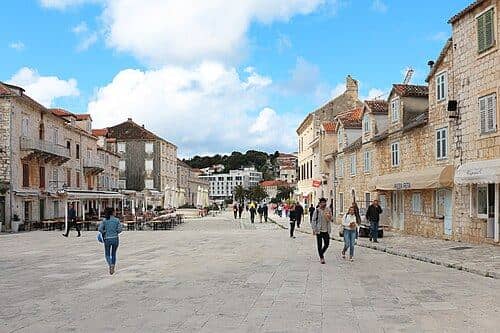
Saint Stephen's Square is the largest old town square in Dalmatia and works as the island's living room, with the cathedral closing it at the eastern end. The building to look for is the Arsenal on the south side: the upper floor holds a theatre opened in 1612, built as a public theatre for all classes at a time when that was unusual anywhere in Europe. Above the town, the Fortica fortress is a twenty minute climb through a walled garden path and repays it with the classic view over the Pakleni islands. Go up for sunset, not midday.
- The Pakleni islands are ten to twenty minutes by taxi boat from the Riva. Palmižana and Jerolim are the usual targets, and the last boat back is earlier than people expect.
- Lavender blooms from roughly mid June to mid July. Outside that window the fields around Velo Grablje are green stalks, not purple.
- The Zavala tunnel to the south coast is single lane, unlit and cut through rock. It is legal and short, but not for nervous drivers.
- Ferries land at Stari Grad, not in Hvar town, and the two are twenty minutes apart by road. Check which port your ticket uses.
Stari Grad and a field system from 384 BC
Greek settlers founded Pharos here in 384 BC, making Stari Grad the oldest town in Croatia, and they divided the plain behind it into rectangular parcels marked by dry stone walls. Those parcels are still there, still the same shape, still farmed. UNESCO listed the Stari Grad Plain in 2008 precisely because it is the best preserved Greek land division in the Mediterranean. Walk or cycle a section of it and the scale becomes clear in a way no photograph manages. In town, Tvrdalj castle, the fortified summer house of the poet Petar Hektorović with its saltwater fish pond, takes half an hour.
“The famous part of Hvar is one square kilometre. The part that has been continuously farmed for twenty four centuries lies twenty minutes inland and has no queue.”
Three days is the honest minimum: one for Hvar town and the fortress, one for a boat to the Pakleni islands, one for Stari Grad, the plain and the road east through Jelsa and Vrboska. If you want the island without the crowds, sleep in Stari Grad or Jelsa and visit Hvar town for an evening rather than the other way round. The southern coast at Sveta Nedjelja and Ivan Dolac is the fourth day if you have it.
Getting to Hvar
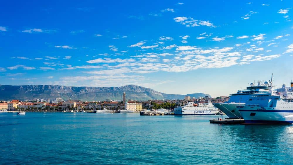
Hvar has no airport. The nearest is Split, about 20 km from the city centre. The passenger catamaran reaches Hvar town in about 1 hour for 10 to 25 euro per person. The car ferry reaches Stari Grad in about 2 hours, with foot passengers paying around 6 to 8 euro and a car 36 to 48 euro. Catamarans leave from Obala Lazareta in front of the Split old town, car ferries from the numbered piers a 10 minute walk south. Driving up the coast from Dubrovnik, cross from Drvenik to Sućuraj at the eastern tip, about 20 minutes, then allow around 1 hour 30 minutes for the 80 km road west.
Getting around and inland
A single road runs the length of the island from Hvar town through Stari Grad and Jelsa to Sućuraj. Buses link the towns and meet most ferries at Stari Grad, where the ride to Hvar town takes about 25 minutes for a few euro, or 35 to 45 euro by taxi. Beyond the towns the bus is thin, so the south coast, the lavender villages and the peak need a car or scooter. Hvar old town is closed to cars and the summer parking above it fills early, so ask your host about parking before you come. With wheels, add these inland stops.
- Velo Grablje, 300 m up in the saddle above Milna cove, is a 15th century farming village that became the centre of lavender distilling on Hvar.
- Malo Grablje, the abandoned village in the stony valley below it, lived on lavender, wine and olives before its families moved down to the coast.
- Sveti Nikola, at 626 m the highest point of Hvar, has a medieval church on the summit and no shade, so start early and skip it in bora wind.
- Likorova kuća above Stari Grad is a ruined 19th century wine estate on a field track through olive groves, an easy walk or bike ride.
Beaches within reach of Hvar town
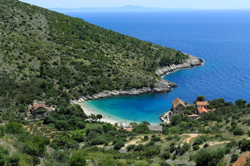
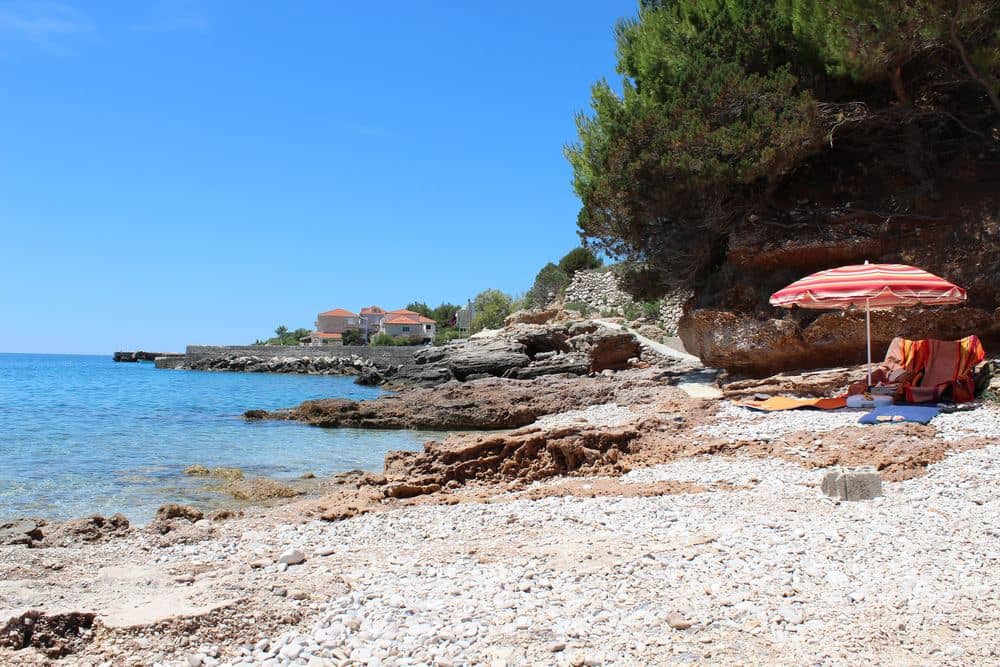
Hvar town has no beach of its own, so the swimming is in coves on either side of the harbour or out on the islands. A 10 minute walk west along the sea brings you to Bonj, with stone arcades and cabins from the period after 1920 when Hvar's earliest hotels opened. East of the harbour, Pokonji Dol has the calmest water near town, sheltered by the lighthouse islet. Further out along the old road to Stari Grad, Zaraće and Dubovica are the coves worth a car. All are pebble or rock, so bring swimming shoes.
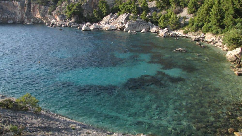
| Cove | From Hvar town | How to get there | Sea and shore |
|---|---|---|---|
| Bonj | 10 minute walk west | On foot along the shore | Stone platforms and arcades, easy entry |
| Pokonji Dol | Just over 1 km east | On foot or taxi boat | Fine pebbles, gradual entry, nearly always calm |
| Mekićevica | Behind the eastern headland | Taxi boat, about 10 minutes, or a 3 km gravel track | Small pebble cove, no car access |
| Zaraće | On the old road, before Dubovica | Car, then a path down | 2 coves joined by a swim-through rock passage, colder sea |
| Dubovica | 8 km east on the old road | Car, then a path down | Pebbles and larger stones, deepens quickly |
Hvar town beyond the square
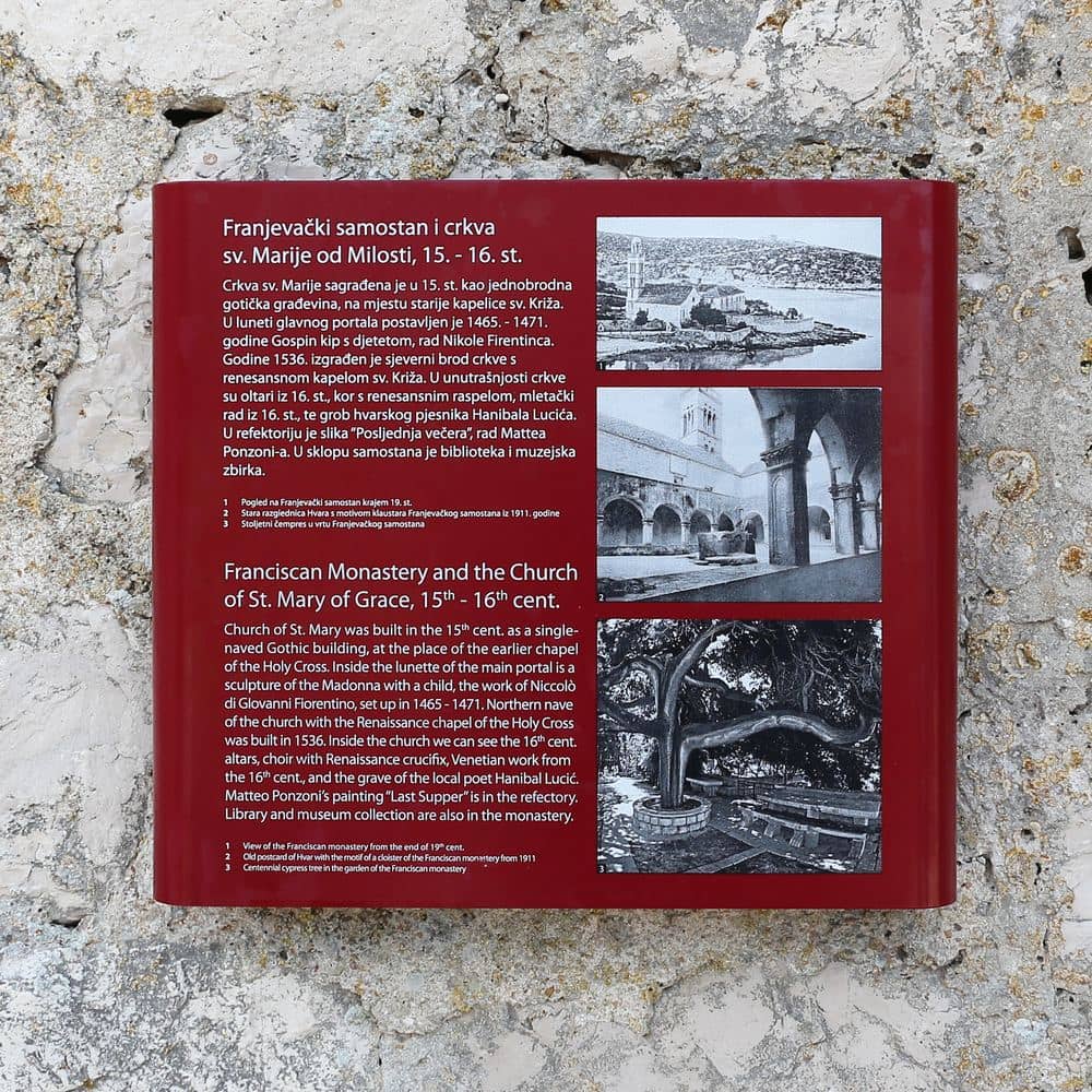
Hvar town has 3 smaller sights for another morning. The Franciscan monastery of 1461 stands on the shore south east of the old core, with a cloister, a cypress more than 300 years old and a Last Supper canvas in the refectory. The Benedictine monastery occupies the former house of the poet Hanibal Lucić and shows lace that the nuns work from agave fibre, a craft found nowhere else. Above Fortica, a further climb reaches the Napoleon fortress of 1811, a French artillery position covering the land side. The ground there is rough and unfenced in places, so wear firm shoes.
Markets for self-catering
The markets show what each town has for self-catering. Hvar's Pjaca market works in the shade along the northern edge of the main square and is small, because the island farms terraces in small quantities. The fish market is a covered building at the western end of the harbour, with sardines and anchovies in spring and summer and hake, scorpionfish and red mullet all year. Stari Grad has the best vegetables on the island because the plain lies directly behind the town, and its market sets up every morning a few steps from the waterfront. Jelsa's market under the plane trees adds figs, carobs, almonds and, in late autumn, mandarins from the Neretva valley.
When to go
May and June are the months for the plain, the villages and the peak: warm enough for early swims, cool enough to walk, with lavender from mid June. July and August bring the heat, the boats and the nightlife, and the afternoon catamarans back to Split sell out days ahead, so book online once your dates are fixed. September is the best month for the sea, still warm after the summer. Ferries switch to the off-season timetable on 28 September 2026: the Stari Grad ferry drops to 3 or 4 crossings a day and the Jadrolinija catamaran runs until 11 October. In a strong bura the catamarans stop before the car ferry does, so keep that option in mind. From November to April many places close and sailings are few.
The places, one by one
| Place | What it is | Time needed |
|---|---|---|
| Hvar Loggia | 17th century arcade on the main square | 10 minutes |
| Arsenal & Hvar Theatre | Theatre of 1612 above a former galley store | 20 minutes |
| Fortica (Spanish Fortress) | 16th century fortress with harbour terrace | 1 to 2 hours |
| Galešnik Island | Islet with Venetian fort ruin and beach club | 2 to 3 hours |
| Jerolim Island | Nearest Pakleni islet, part naturist | half a day |
| Palmižana Marina | Marina, botanical garden and beach on Sveti Klement | half a day |
| Stari Grad Riva | 1.5 km waterfront along a 6 km bay | 1 hour |
| Stari Grad Museum | Shipwreck cargo and paintings in the Biankini palace | 40 minutes |
| Jelsa Riva | Harbour front with a plane tree park | 1 to 2 hours |
| Vrboska Harbour | Canal village with a fortified church | 1 hour |
| Zavala Beach | South coast pebble beach beyond the tunnel | half a day |
| Sveta Nedjelja Cliffs | Village under a cliff with a cave monastery | 2 to 3 hours |
| Sućuraj Harbour | Ferry village at the eastern tip with lighthouse | 1 to 2 hours |
Hvar Loggia
The loggia stands on the eastern side of the square beside the clock tower and is the only part of the rector's palace to survive the burning of 1571. It went up at the beginning of the 17th century, its design credited to builders trained in Venice: 7 arches on columns, a stone bench along the wall and a beamed ceiling. Under Venetian rule judgments were read out and business concluded here, because proceedings had to be public. In the 19th century a hotel grew beside it and the loggia stayed as an open passage to the waterfront. Today you use it to sit out of the sun. The clock tower next to it has kept time since the 16th century.
Arsenal & Hvar Theatre
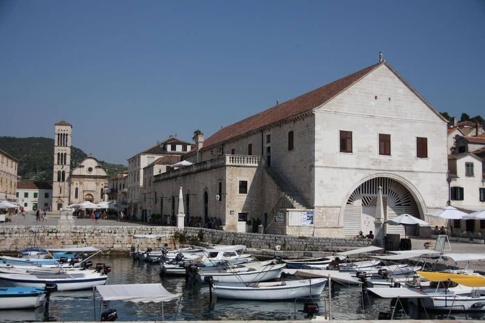
The ground floor of the Arsenal was a shipyard and a galley store. The ships of the Hvar commune were repaired and wintered in the large covered hall by the shore, and after the Ottoman fleet burned it in 1571 the building was rebuilt in 1611. The theatre was fitted into the upper floor the following year. Inside you find wooden boxes in 2 tiers and a small stage. After a long restoration the space has reopened to visitors. The entrance is beside the main square, tickets are cheap, and 20 minutes is enough for the visit, so it fits between a coffee on the square and the climb to Fortica.
Fortica (Spanish Fortress)
Fortica, also called Španjola, sits about 100 m above the town and took its present shape in the 16th century. The trigger was 1571, when the Ottoman fleet burned Hvar: the new fortress was meant to shelter the whole population and to cover the harbour entrance and the Pakleni archipelago with cannon. In 1579 lightning hit the powder magazine and blew out part of the walls, so what you see was rebuilt at the end of that century. Inside are the dungeons and a small collection of amphorae raised from the seabed. The terrace shows the harbour with every islet laid out below. Tickets are cheap. The way up is steep steps and a path, so wear proper shoes.
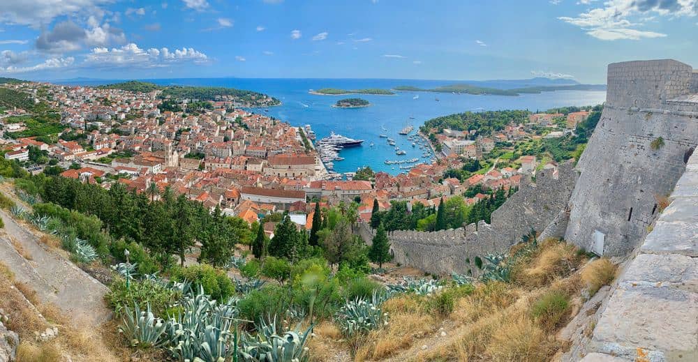
Galešnik Island
Galešnik is the smallest and nearest of the islets in front of the harbour, only a few hundred metres from the waterfront, so a boat reaches it in about 5 minutes. On top stand the remains of a small fort the Venetians built in the 16th century to close the harbour entrance with crossfire from here and from Fortica. The fort was abandoned and only its stone ground floor is left. The shore is rock with concrete sunbathing platforms and a steep drop into deep water, so it suits confident swimmers. In season the islet runs as a day beach club with a bar and loungers. Come in the afternoon, when you look back at the town harbour against the light.
Jerolim Island
Jerolim is the first islet of the Pakleni chain, less than 1 km from the harbour, and the quickest swim from town. The name comes from a former chapel of St Jerome that no longer exists. The shore is rock with a few small pebble coves and concrete platforms, and the water is deep and very clear, since there is no river mouth and no sand. The islet has been a naturist bathing place since the years after 1960, and today nude and clothed bathing use separate stretches of shore, so check which side you land on. The interior is dense pine wood with narrow paths. Taxi boats run every half hour in season and take about 10 minutes. A single bar works on the island.
Palmižana Marina
Palmižana is a cove on the northern side of Sveti Klement, the largest island of the Pakleni chain, and the only place in the archipelago with a proper marina, sheltered from both the bura and the southerly. Above the cove lies a botanical garden that the Meneghello family started planting at the beginning of the 20th century, with palms, agaves, cacti and species brought back from their travels, and the pavilions and restaurants that grew up around the garden still work today. Over the low hill, a 15 minute walk, is a pebble beach facing south. Taxi boats from Hvar take about 20 minutes. Half a day covers the visit, and you want shoes for the forest paths.
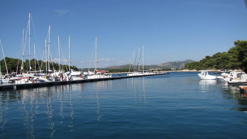
Stari Grad Riva
The bay of Stari Grad reaches 6 km inland from the open sea, which is why the Greeks chose it for Pharos: ships lay safe from every wind. That length keeps the water along the waterfront calm nearly all year. The promenade follows the shore from the port to the old part of town, about 1.5 km, past stone houses with fishermen's ground floors, several baroque summer villas and the small church of St Roch. Ferries from Split dock 2 km west of the old centre in Stari Grad port, and a bus runs from there. You walk it best toward evening, when the whole bay turns to face west.
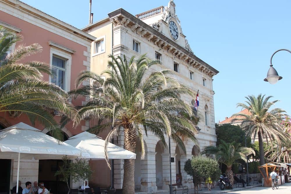
Stari Grad Museum
The museum occupies the Biankini palace on the waterfront, a 19th century house built by a shipowning family. The main display is the cargo of a ship that sank off Cape Vela Stiniva in the 1st century BC: amphorae, ship's gear and parts of the load, recovered from the seabed and showing what trade in this part of the Adriatic looked like. There is also a mosaic from a Roman villa and a collection of paintings by Juraj Plančić, born in Stari Grad in 1899, who died young in Paris. The display is easy to take in and about 40 minutes covers it. It pairs well with the plain: you see here what the estates out there produced and shipped.
Jelsa Riva
Jelsa lies on the northern shore in a bay closed on both sides by headlands, and the town grew around its harbour in the 16th century as people from the hill villages came down to the sea. The waterfront rings the inner basin and runs into a park of plane trees planted at the end of the 19th century, one of the few real parks on any Dalmatian island. Beside it are the square with its summer stage and the Slatina spring, where fresh water surfaced close to the sea and gave the place its name. Catamarans link Jelsa with Split and with Bol on Brač. Along the promenade you reach the coves of Mina and Grebišće, the best swimming nearby, in about 30 minutes.
Vrboska Harbour
Vrboska is the smallest settlement on the island, founded in 1465 when farmers from Vrbanj came down to the sea and built a harbour at the head of a narrow bay about 1 km long. A channel runs through the village and several stone bridges cross it, which is where the nickname of little Venice comes from. The odd one out is the church of St Mary: in the 16th century the villagers fortified it with walls and gun loops as a refuge from Ottoman raids, so it looks like a fortress. There is also a fishing museum, one of the first of its kind in Croatia. Vrboska is a few kilometres from Jelsa, and you walk the whole place in about 1 hour.
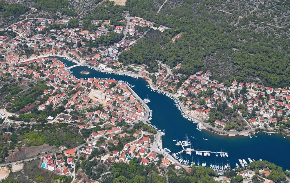
Zavala Beach
Zavala is the village at the southern end of the Pitve tunnel, facing Korčula and the open sea. The tunnel is about 1.5 km long and was cut after 1960 out of a water-supply gallery, which explains its size: it has room for a single vehicle, so you wait at the mouth until oncoming traffic has cleared before you drive in. The tunnel is the reason this shore stayed thinly settled for so long. The beach is pebbly and narrow, with very clear water that gets deep fast, and the slopes above are terraced with plavac mali vines. Several taverns work in the village. The sun stays on the beach until late in the afternoon, so it suits the second half of the day.
Sveta Nedjelja Cliffs
Sveta Nedjelja sits under a vertical cliff on the southern side of the island, below Sveti Nikola. About 100 m above the houses a large cave opens, and in the 15th century Augustinian hermits fitted a small monastery and church into it. A steep path climbs to the cave in about 30 minutes, and from the mouth you see the whole southern channel. The slopes around the village tilt at nearly 45 degrees and are planted with plavac mali, the source of the best-known red wines on Hvar. The cliff itself is a climbing area with several dozen routes, and the shortest ascent of Sveti Nikola starts here, about 1 hour 30 minutes up through maquis. A winery and several taverns work in the village.
Sućuraj Harbour
Sućuraj is the easternmost settlement on Hvar and in every way the opposite of Hvar town: a few hundred permanent residents, a harbour in a small cove and fishing boats along the shore. Its ferry to Drvenik is the shortest ferry link on the Adriatic, and in summer you should book it, because the queues get long. In the village stands a 17th century Franciscan monastery, and several pebble coves lie nearby. From the harbour a 20 minute walk reaches the lighthouse on the cape, built in 1889, where the channel to the mainland narrows to a little over 4 km and the Biokovo range fills the view opposite. The interior is closed and the shore around it is rock, without beaches.
Watch
Hvar on video
A short official city film to help you picture the place before you go.
The light of Hvar
Frequently asked questions
- Is Hvar only a party island?
- No, and the nightlife is confined to a small part of Hvar town, mostly around the harbour and a few clubs. The island is 68 kilometres long. Stari Grad, Jelsa and Vrboska are quiet working towns, the southern coast is vineyards and near empty coves, and the Stari Grad Plain is a UNESCO listed Greek field system still under cultivation. Sleeping outside Hvar town gives you a completely different island.
- When does the lavender on Hvar bloom?
- Roughly from mid June to mid July, with the peak usually in late June. The fields are concentrated inland around Velo Grablje and Brusje on the road between Hvar town and Stari Grad. Outside the flowering window you will still find lavender products everywhere, but the fields themselves are cut back and green. Harvest happens in July, so late June combines full colour with the scent of the distilling.
Share this guide
Questions about your trip?