Prošćansko jezero è il punto in cui iniziano i laghi di Plitvice: il primo e il più alto dei sedici, a 638 m, lungo 2.1 km, profondo 37 m e di 68 ha, secondo per dimensione solo al Kozjak. Quasi nessuno lo percorre a piedi, perché le passerelle e le grandi cascate si trovano altrove. È proprio questo il punto. Quali programmi lo raggiungono dall'Ingresso 2, com'è la passeggiata lungo la riva, e quanto costa un biglietto in ottobre e novembre.
Verificato: 21 September 2026
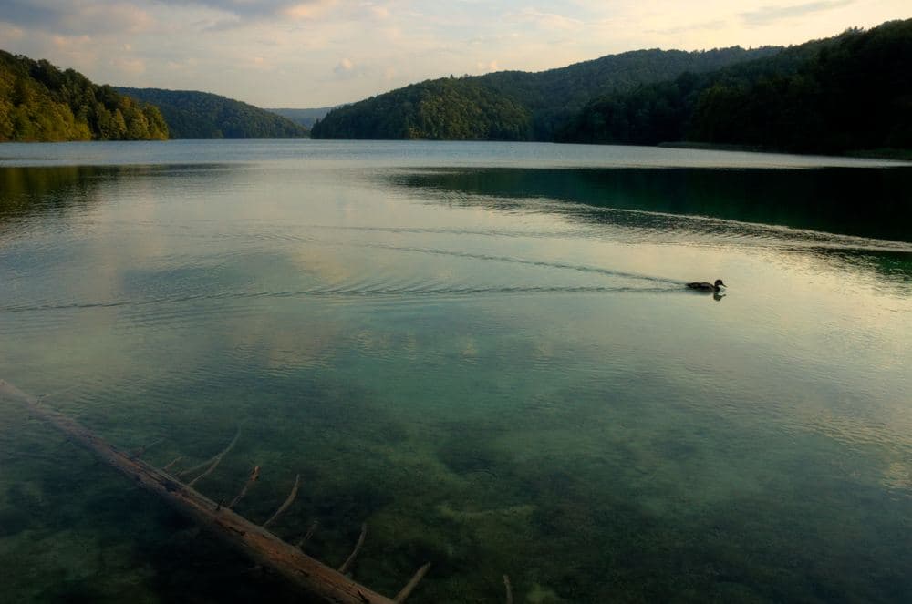
L'acqua di Plitvice entra dall'alto, al Prošćansko jezero. Due corsi d'acqua, la Crna rijeka e la Bijela rijeka, si uniscono vicino alla frazione di Plitvički Ljeskovac per formare la Matica, e la Matica riempie il primo lago, lungo e stretto: 2.1 km da sud a nord, largo tra 180 e 400 m, profondo al massimo 37 m e di 68 ha di superficie, a 638 m sul livello del mare. Solo il Kozjak, il lago attraversato dalle barche elettriche, è più grande, con 81.5 ha. Dall'estremità settentrionale del Prošćansko l'acqua scende oltre la barriera di Labudovac e la sua cascata verso Ciginovac e Okrugljak, e da lì attraverso il resto dei dodici laghi superiori fino al Kozjak e giù per il canyon dei laghi inferiori. Il nome deriva da prošće, pali: si racconta di uno steccato di pali che un tempo chiudeva il lago.
| Voce | Valore |
|---|---|
| Posizione nel sistema | primo e più alto dei 16 laghi, gruppo dei Laghi Superiori |
| Altitudine | 638 m |
| Superficie | 68 ha (Kozjak: 81.5 ha) |
| Profondità | 37 m (Kozjak: 47 m) |
| Lunghezza e larghezza | 2.1 km, da 180 a 400 m |
| Alimentato da | la Matica (Crna e Bijela rijeka) |
| Deflusso | barriera e cascata di Labudovac verso Ciginovac e Okrugljak |
Perché è deserto
La Plitvice che tutti fotografano è il canyon dei laghi inferiori e le passerelle tra Galovac e Kozjak. I percorsi dall'Ingresso 1 (A, B, C) non si avvicinano mai al Prošćansko, e il percorso più popolare dall'Ingresso 2, il programma H, parte dalla fermata di Labudovac all'estremità settentrionale del lago e scende subito verso le cascate. La riva del Prošćansko è invece un sentiero nel bosco lungo un lago immobile: nessuna cascata, nessuna passerella di legno sopra acqua corrente, nessun punto panoramico con la coda. In un giorno feriale di ottobre si possono percorrere i suoi due chilometri incontrando più anatre che persone.
Quale programma raggiunge il lago
- Programma E, dall'Ingresso 2, 5.1 km, da 2 a 3 ore: una breve traversata del Kozjak in barca elettrica, poi la camminata controcorrente lungo i laghi superiori fino al Prošćansko jezero, e il ritorno con il veicolo panoramico. Il modo più rapido per vedere l'intera scalinata dei laghi superiori terminare nel primo lago, immobile.
- Programma K2, dall'Ingresso 2, 17.5 km, da 6 a 8 ore: il lungo anello dell'intera zona dei laghi, che comprende il sentiero costiero lungo il Prošćansko. Il programma K dall'Ingresso 1 (K1, 16.5 km) ne è il gemello dall'altra estremità. Entrambi sono percorsi a piedi con la sola traversata in barca del Kozjak.
- Programma H, dall'Ingresso 2, 8.9 km, da 4 a 6 ore, il più popolare, tocca solo l'estremità settentrionale del lago a Labudovac prima di scendere lungo i laghi superiori, attraversare il Kozjak e proseguire tra i laghi inferiori. Se si vuole vedere il Prošćansko in un giorno affollato, si può iniziare con l'H e aggiungere la passeggiata sulla riva da Labudovac prima di scendere.
- Il programma F dall'Ingresso 2 (4.6 km) risulta temporaneamente chiuso sul sito del parco, con aggiornamento a settembre 2026. I programmi A, B e C dall'Ingresso 1 non raggiungono affatto i laghi superiori.
Prezzi e orari autunnali
Il listino prezzi 2026 del parco prevede tre stagioni. Dal 1 al 31 ottobre un biglietto giornaliero costa 23 euro per gli adulti, 14 per gli studenti e 6 per i bambini da 7 a 18 anni, con le auto a 1.50 euro all'ora nei parcheggi. Dal 1 novembre al 31 marzo scende a 10, 6 e 4 euro. Tra giugno e settembre era di 40 euro. I bambini sotto i 7 anni entrano gratis. Le barche e i veicoli panoramici hanno un orario ridotto in autunno; controllare le ultime partenze all'ingresso prima di partire per l'E o il K, perché il ritorno a piedi da Labudovac all'Ingresso 2 senza veicolo è lungo. Alla fine di ottobre i boschi di faggio intorno al Prošćansko cambiano colore, e il lago, senza folla e senza vento, è al suo meglio.
Getting to Entrance 2
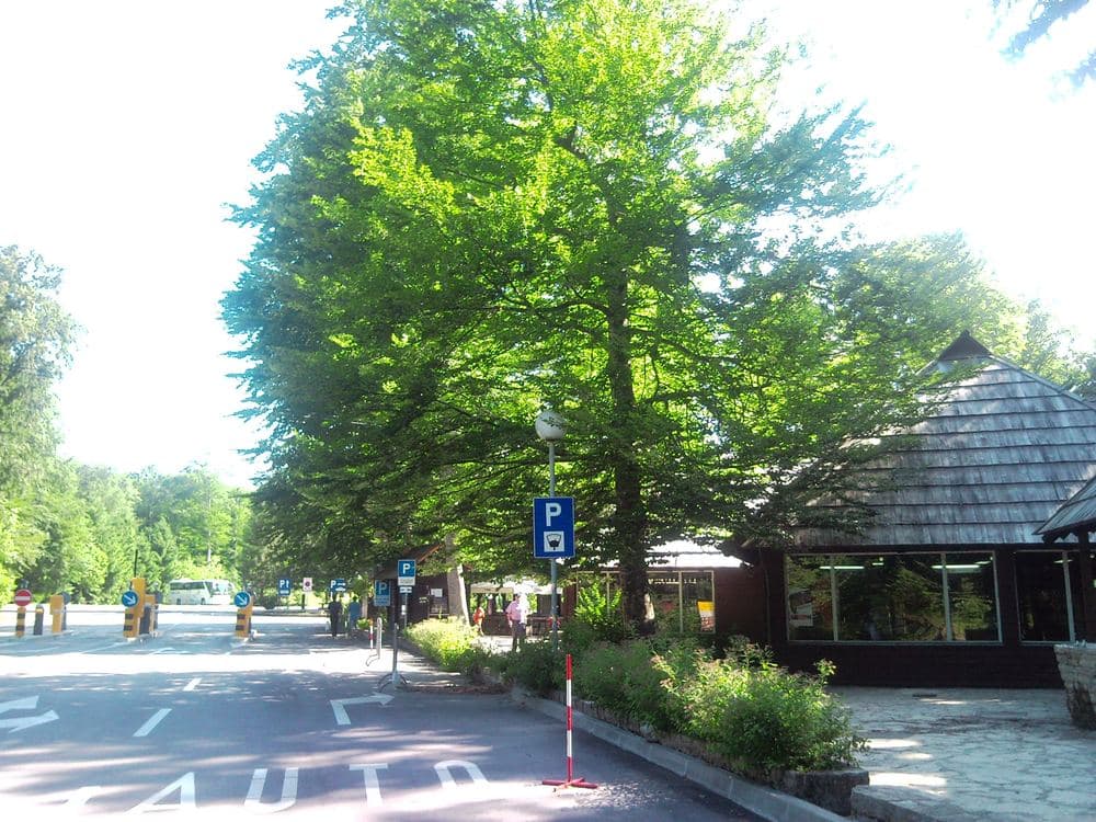
Entrance 2 is at Hladovina, on the D1 road in the southern part of the park, between the settlements of Mukinje and Jezerce. From Zagreb you leave the A1 at Karlovac and follow the D1 south through Slunj and Rakovica, about 130 km and 2 hours. You pass Entrance 1 at Rastovača first, Entrance 2 is about 3 km further on. From Split and Zadar the A1 exit is Gornja Ploča, then Udbina and Korenica. Buses between Zagreb and the coast along the D1 stop at both entrances, ask for Ulaz 2 or Hladovina. Online tickets are tied to an entrance and an arrival slot, so choose Entrance 2 when you book.
| From | Distance | Time | Route |
|---|---|---|---|
| Zagreb | 130 km | about 2 h | A1 to Karlovac, D1 through Slunj and Rakovica |
| Zadar | 130 km | about 1 h 45 | A1 to Gornja Ploča, then Udbina and Korenica |
| Split | 250 km | about 3 h | A1 to Gornja Ploča, then Udbina and Korenica |
| Korenica | 10 km | about 15 minutes | D1 north |
| Entrance 1 (Rastovača) | 3 km | 5 minutes | D1 south |
The walk from the boat to the lake
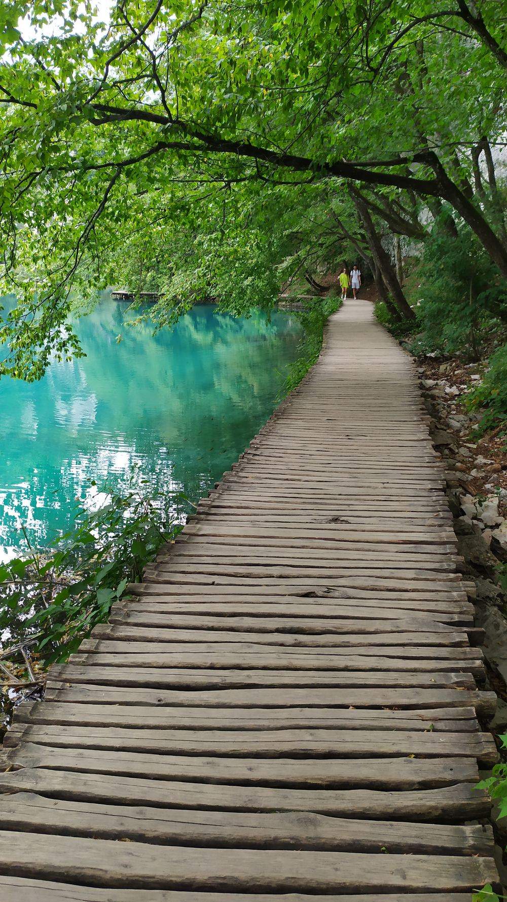
Programme E begins with the short boat crossing of Kozjak below Entrance 2. From the far dock you walk upstream along the Upper Lakes: the Burgeti pools, Gradinsko with its reeds and herons, Galovac under Veliki and Mali Prštavac, then Batinovac and Okrugljak. Kozjak lies at about 535 m, so the whole walk climbs about 100 m. Ciginovac, the second lake, sits below the path near the top, dark under beech. The boardwalks end at Labudovac, where Prošćansko drops some 20 m into Okrugljak over a wide barrier with a cave hollowed out beneath it. Above the barrier you stand at the northern tip of the first lake, a few minutes from the vehicle stop.
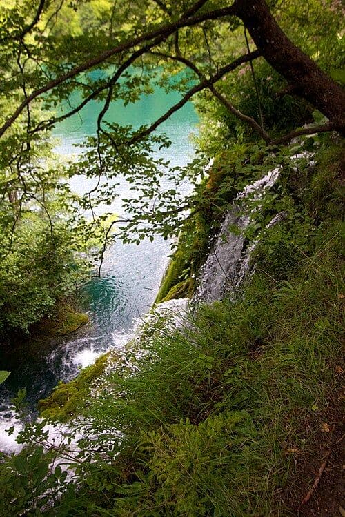
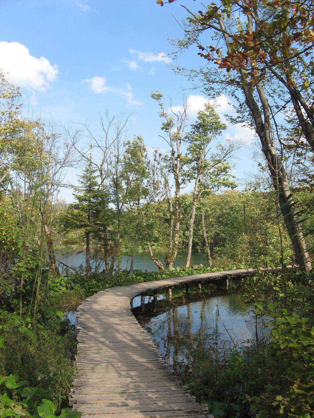
From Labudovac the shore path heads south along the lake as an earth and gravel forest track, mostly level, under beech that reaches the water. There are no boardwalks and no railings on this stretch, and nothing falls: the lake is simply still, with the far shore 180 to 400 m away. If you are on E, walk out as far as your timing allows and return the same way, because the vehicle at Labudovac is your way back to Entrance 2. At the southern end the Matica comes in from the hamlet of Plitvički Ljeskovac. Stay on the path: stepping off it to reach the water is forbidden throughout the lake zone.
What to bring
The shore of Prošćansko has none of the services of the busy part of the park. Between the Labudovac stop and the far end of the lake there is nothing to buy and nowhere to shelter, and the walk there and back adds about 4 km to programme E. Pack as you would for a short forest hike at 600 m on the Lika plateau: the air by the water is colder than at the entrance in the sun, and the beech canopy keeps the path damp for days after rain.
- Shoes with grip: the shore path is earth, roots and loose stone, and the boardwalks below Labudovac are wet timber without railings.
- Water and a packed lunch from the shop in Mukinje or from home, there is no kiosk on the shore.
- A warm layer and a hat: at 638 m, October mornings are cold and fog sits on the lake until it lifts.
- A rain jacket, the path is too narrow and rooty for an umbrella.
- Your ticket, printed or on your phone, it is checked when you board the boat and the vehicle.
- A downloaded map, mobile signal is weak in the forest along the shore.
Light, fog and the season
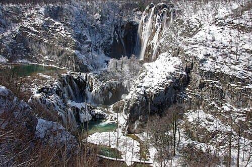
The day at Prošćansko is set by daylight and the vehicle timetable, and in autumn both shrink. After the clocks change at the end of October the sun is down before 17:00, and under the beech on the shore the light goes half an hour earlier. On still mornings fog lies on the lake and in the valley of the Upper Lakes, so an early boat buys empty boardwalks and the clear view of the water comes around midday. From November the park may close the Upper Lakes paths and stop the boats in snow and ice, and the shore path goes with them. October is the last month you can count on it, and April and May, with Labudovac at full flow after the snowmelt, are the first.
Where to stay and eat
The closest beds are at Entrance 2 itself: the park's own hotels stand next to the gate, which makes the first boat easy. Just south along the D1 is Mukinje, built for park staff after the park was founded, with the nearest shop, a post office and a few restaurants that fill in the afternoon with walkers coming off the loop. Jezerce, the next village, has guest houses and apartments. Korenica, 10 km south, is the town: supermarkets, bakeries, a petrol station and cheaper rooms, and the place to stock up if you cook for yourself. Plitvica Selo, north of Entrance 1, has farmhouse apartments, but from there Entrance 2 is a drive.
Domande frequenti
- Quanto è grande e quanto è profondo il Prošćansko jezero?
- 68 ha, lungo 2.1 km, largo da 180 a 400 m e profondo 37 m, a 638 m sul livello del mare. È il primo e il più alto dei 16 laghi di Plitvice ed è il secondo più grande dopo il Kozjak.
- Quale programma di Plitvice percorre a piedi il Prošćansko jezero?
- Il programma E dall'Ingresso 2 (5.1 km, da 2 a 3 ore) sale lungo i laghi superiori fino al Prošćansko, e il lungo anello K2 (17.5 km) ne comprende la riva. Il programma H tocca solo l'estremità settentrionale a Labudovac.
- Quanto costa Plitvice in ottobre 2026?
- 23 euro per gli adulti, 14 per gli studenti e 6 per i bambini da 7 a 18 anni, dal 1 al 31 ottobre; dal 1 novembre sono 10, 6 e 4 euro. Il parcheggio costa 1.50 euro all'ora per le auto.
Fonti ufficiali
Luoghi, eventi e video selezionati per Laghi di Plitvice.
Croatia Atlas tra le fonti preferite
Un clic e Google ti mostra più spesso i nostri articoli nelle notizie principali e nelle risposte AI. Cambia solo i tuoi risultati.